This is a really fat Demo
...which goes far beyond stuff from other competitors.
- built as Docker-Image
- covers the entire world
- targets many logistic issues
-
Well, the demo's data is limited because of its dockerized size and only contains
- most important Ports and Airports from several OpenGeoData sources
- tons of major cities and bigger towns
- the german Mainroad- and River-Network from OpenStreetMap
- TimeZones and crucial maritime Zones like Channels, Secas, etc.
- you can block Zones and Hubs (Ports or Airports) in order to find alternative routes.
- once a good route is found, you can re-calculate departures and times to get closer to your plannings
This Demo assumes you have Docker installed, up and running!
The simplest way to start it is via your preferred terminal.
docker run --name "osm2po-world-demo" -p 80:8888 cmindividual/osm2po-world-demo:de
then just open your Browser and navigate to localhost
or click here
First Steps to understand this Demo
- Click on "Search" or type "Ctrl-F" and look for "Pinn" and select Pinneberg
- A PopUp opens, click on "Source" to set the green flag to set the starting position
- Double Click somewhere on the Ocean to set the "Target"
- Finally Click on "Route"
- Another Popup opens which lets you jump to the legs of the route
- A click on "Rework" lets you set other parameters to find alternative routes
- A click on "Schedule" lets you fine tune departures, arrivals, speeds and times.
Remember:
This Demo only covers german streets and maritime data.
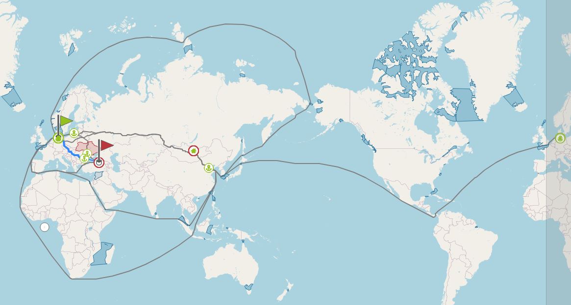
Here are some impression of what is possible with all
main roads from the OpenStreetMap Planet file.
The first one shows alternative routes from Pinneberg
to Ulaanbaatar.
A Click on "3Demo" opens this playground